
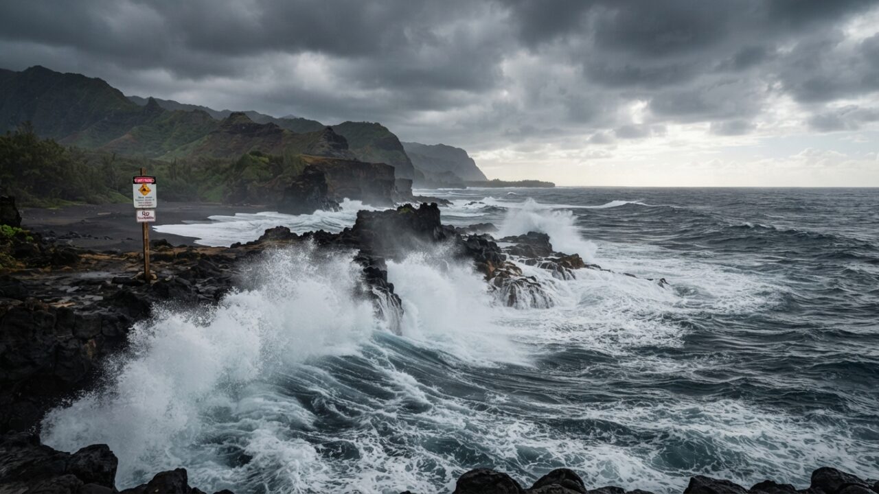
Hurricane Lowell, a major Category 3 storm churning in the eastern Pacific Ocean, is generating life-threatening surf conditions that are expected to impact the Hawaiian Islands through the Labor Day weekend, according to forecasters at the National Weather Service and the Central Pacific Hurricane Center.
The hurricane, which strengthened rapidly over warm ocean waters earlier this week, currently maintains maximum sustained winds of approximately 120 miles per hour. While the storm’s center is tracking well away from the island chain, its powerful circulation is producing significant swells that will propagate westward across hundreds of miles of open ocean.
Wave Heights and Coastal Impacts Expected
Forecasters warn that surf heights along south-facing shores could reach 10 to 15 feet, with some localized areas potentially experiencing waves exceeding 20 feet during peak periods. These conditions pose serious risks to swimmers, surfers, and anyone venturing near the shoreline.
The National Weather Service has issued High Surf Warnings for multiple Hawaiian counties, urging residents and visitors to stay out of the water and away from the shore during periods of high surf. Beachgoers are advised to heed all posted warnings and closures implemented by local authorities.
Ocean Safety officials across the islands have increased patrols and positioned lifeguards at popular beaches. Several county parks departments have already announced temporary closures of beach access points where conditions are deemed too hazardous for public safety.
Storm Track and Intensity Forecast
Hurricane Lowell formed off the western coast of Mexico earlier this week and has since moved into the central Pacific basin. The storm’s current trajectory keeps it positioned approximately 1,200 miles east-southeast of Hilo on Hawaii Island, though this distance varies as the system continues its westward movement.
Meteorologists expect Lowell to maintain major hurricane status for at least another 24 to 48 hours before encountering cooler waters and increased wind shear that typically weaken tropical systems in this region of the Pacific. However, even as the hurricane gradually loses intensity, the swell energy it has already generated will continue moving toward Hawaii.
The Central Pacific Hurricane Center emphasizes that while direct impacts from the hurricane’s core winds and rain are not anticipated, the indirect effects through dangerous marine conditions remain a significant concern for coastal communities.
Historical Context and Seasonal Patterns
The eastern and central Pacific hurricane season runs from May 15 through November 30 each year, with peak activity typically occurring between July and September. Hawaii’s geographic location places it within range of swells generated by distant tropical cyclones, even when the storms themselves never approach the islands.
Previous hurricanes have generated similar long-distance swell events impacting Hawaii. These episodes consistently prove dangerous, with strong rip currents, shore breaks capable of knocking people off their feet, and waves that can sweep individuals off rocks and jetties without warning.
Local emergency management agencies maintain that coastal flooding is also possible during high tide cycles, particularly in low-lying areas where wave run-up can inundate roads, parking lots, and beachfront properties. Residents in vulnerable coastal zones are advised to move vehicles and equipment away from the immediate shoreline.
Safety Recommendations for Residents and Visitors
Ocean safety experts stress several critical precautions during high surf events:
- Never turn your back on the ocean when near the shore, as wave sets can arrive suddenly with little warning
- Stay well back from the water’s edge, especially on rocky coastlines where waves can surge unexpectedly
- Avoid walking on wet rocks, jetties, or other structures where footing becomes treacherous
- Keep children and pets away from the shore during warning periods
- If caught in a rip current, swim parallel to shore rather than fighting directly against the current
Tourism officials note that Labor Day weekend traditionally brings increased visitor numbers to Hawaiian beaches. Hotel concierges and tour operators have been asked to inform guests about current ocean conditions and direct them to safer activities during the high surf advisory period.
Broader Pacific Storm Activity
Hurricane Lowell is not the only system currently active in the Pacific basin. Meteorologists are monitoring additional areas of disturbed weather in the eastern Pacific that show potential for development in coming days, though none currently pose immediate threats to populated areas.
The 2025 hurricane season has thus far produced above-average activity in the eastern Pacific, with Lowell marking the twelfth named storm of the year. This elevated activity aligns with seasonal forecasts that predicted a more active than normal season due to prevailing ocean temperature patterns and atmospheric conditions.
Climate researchers continue studying long-term trends in Pacific hurricane behavior, including potential shifts in storm tracks, intensification rates, and the frequency of rapid strengthening events like the one that transformed Lowell from a tropical storm into a major hurricane within 36 hours.
Monitoring and Updates
The Central Pacific Hurricane Center issues updated forecasts and advisories every six hours, with intermediate updates provided as conditions warrant. Local National Weather Service offices supplement these with detailed marine forecasts and coastal hazard statements specific to individual Hawaiian counties.
Emergency management officials encourage residents to monitor official sources for the latest information rather than relying on social media or unofficial channels. Conditions can change rapidly, and warning levels may be upgraded or downgraded based on observed wave heights and evolving forecast data.
Marine interests including commercial shipping, fishing fleets, and recreational boaters have been advised to exercise extreme caution and consider postponing non-essential ocean activities until conditions improve. Harbor masters across the islands have implemented small craft advisories and restricted access to certain channels and approaches.
Forecasters indicate that surf heights should begin gradually diminishing by early next week as Hurricane Lowell weakens and its swell energy dissipates across the vast Pacific. Until then, vigilance and respect for ocean conditions remain essential for safety across the Hawaiian Islands.
